
Keyword
Optical Microscopes
47 record(s)
Type of resources
Topics
Keywords
Contact for the resource
Provided by
Formats
Update frequencies
Status
draft
-
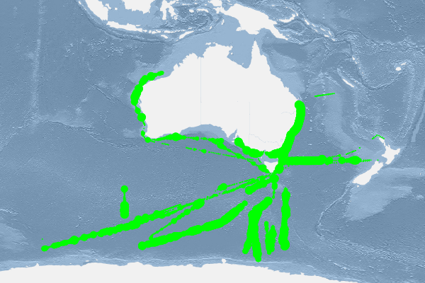
This dataset contains data collected by the Australian Continuous Plankton Recorder (AusCPR) survey and is funded by IMOS (Ships of Opportunity sub-facility) and CSIRO. The aims of the AusCPR survey are to: * map plankton biodiversity and distribution * develop the first long-term plankton baseline for Australian waters * document plankton changes in response to climate change * provide indices for fisheries management * detect harmful algal blooms * validate satellite remote sensing * initialise and test ecosystem models. The survey conducts repeat tows in the GBR, the East Australian Current and down to the Southern Ocean Time Series Mooring (SOTS). Other routes are conducted on an adhoc nature around Australia. The dataset also contains phytoplankton data from the UTAS / AAD led Southern Ocean CPR (SOCPR) project which is also funded by IMOS. The datasets available in this collection include Phytoplankton Colour Index (an estimate of chlorophyll in the water), phytoplankton abundance, zooplankton abundance and a biomass index from AusCPR and phytoplankton abundance from SOCPR. This data are freely available through the AODN portal: https://portal.aodn.org.au. This data is freely available but please acknowledge all relevant parties, as detailed in acknowledgement section.
-

This dataset comprises the phytoplankton abundance and biovolume estimates as part of a broader sampling program carried out at the Southern Ocean Time Series, a facility within the Integrated Marine Observing System (IMOS). The primary focus is sustained observing of ocean properties and processes important to climate, carbon cycling, and ocean productivity. Regular phytoplankton samples are collected at approximately 14 day intervals (exact intervals and seasonal coverage dependent on deployment length). The moorings are serviced annually, at which time the existing moorings are recovered and new moorings are deployed. Water samples from within the surface mixed-layer are collected at pre-programmed intervals using a Remote Access Sampler, in pairs about 1 hour apart. One sample in each pair is preserved for phytoplankton community composition by microscopy, and the other sample is preserved and used for accompanying chemical analysis of nutrients, total dissolved inorganic carbon (DIC) and alkalinity. Each sample is collected from within the surface mixed-layer at 32 m depth (2010 - 2017) or 5 m depth (2018-current) depending on the design of the mooring surface assembly and instrumentation. Typically a maximum of 24 samples are collected over an annual deployment cycle. The samples collected are analysed for: 1. Community composition / abundance (cells/L) 2. calculated biovolume (um3/L). Protocols for the phytoplankton time-series are described in Eriksen et al (2018), and the annual sample reports for each deployment. Data storage and access is planned to be interoperable with other national and international programs through the IMOS Infrastructure. Station metadata can be found through this resource. Data is available freely via the AODN portal: https://portal.aodn.org.au. As the taxonomic resolution of the data has changed over time, due to continual training, it is important that users refer to the change log tables included in your data download. These will provide information on the validity of the taxa, from what date we have been identifying certain taxa etc. Classification fields may be blank depending on the level to which that taxa has been identified, i.e. if only identified to family, genus and species will be blank.
-
This dataset contains the results from surveys of epiphyte fauna from 3 sites along the Perth metropolitan coastline, Western Australia. Samples from Warnbro, Shoalwater and Marmion were collected in September 1993. All sites had the seagrasses Posidonia sinuosa and Amphibolis griffithii within 10 m of each other, and in depths of between 3 m and 6 m. At each site the species abundance and biomass of grazers and epifaunal groups, particularly molluscs and crustaceans were determined. This was to assess their suitability as indicator species in monitoring programs.
-
Algal biomass in the Perth region were identified from quadrat surveys , as part of the SRFME research program. The aim of the SRFME Coastal project is to characterize the coastal benthic ecosystems of southwestern WA, with particular focus on benthic reef cosystems, their productivity and dynamics, and the physical, chemical and biological factors driving variability along dominant spatial and temporal scales. To achieve this, we undertook 3-monthly seasonal sampling from 2003 - 2005 at a series of coastal sites situated between Cape Naturaliste in the south and Jurien Bay in the north. Benthic Sampling was integrated with satellite observations of SST, ocean colour and subsurface measurements of other water column properties, as well as sediment biogeochemical sampling. Within this region benthic sampling was nested at Regional (100s km) Local (10s km) and Site (1 km) scales and within each of the regions additional sites were sampled to incorporate site scale variability along cross-shore gradients.
-
Algal biomass in the Rottnest Island region were identified from quadrat surveys , as part of the SRFME research program. The aim of the SRFME Coastal project is to characterize the coastal benthic ecosystems of southwestern WA, with particular focus on benthic reef cosystems, their productivity and dynamics, and the physical, chemical and biological factors driving variability along dominant spatial and temporal scales. To achieve this, we undertook 3-monthly seasonal sampling from 2003 - 2005 at a series of coastal sites situated between Cape Naturaliste in the south and Jurien Bay in the north. Benthic Sampling was integrated with satellite observations of SST, ocean colour and subsurface measurements of other water column properties, as well as sediment biogeochemical sampling. Within this region benthic sampling was nested at Regional (100s km) Local (10s km) and Site (1 km) scales and within each of the regions additional sites were sampled to incorporate site scale variability along cross-shore gradients.
-
Algal biomass in the Jurien Bay region were identified from quadrat surveys as part of the SRFME research program. The aim of the SRFME Coastal project is to characterize the coastal benthic ecosystems of southwestern WA, with particular focus on benthic reef cosystems, their productivity and dynamics, and the physical, chemical and biological factors driving variability along dominant spatial and temporal scales. To achieve this, we undertook 3-monthly seasonal sampling from 2003 - 2005 at a series of coastal sites situated between Cape Naturaliste in the south and Jurien Bay in the north. Benthic Sampling was integrated with satellite observations of SST, ocean colour and subsurface measurements of other water column properties, as well as sediment biogeochemical sampling. Within this region benthic sampling was nested at Regional (100s km) Local (10s km) and Site (1 km) scales and within each of the regions additional sites were sampled to incorporate site scale variability along cross-shore gradients.
-
Algal biomass in the Geographe Bay region were identified from quadrat surveys on Cape Naturaliste and Cape Leauwin reefs, as part of the SRFME research program. The aim of the SRFME Coastal project is to characterize the coastal benthic ecosystems of southwestern WA, with particular focus on benthic reef cosystems, their productivity and dynamics, and the physical, chemical and biological factors driving variability along dominant spatial and temporal scales. To achieve this, we undertook 3-monthly seasonal sampling from 2003 - 2005 at a series of coastal sites situated between Cape Naturaliste in the south and Jurien Bay in the north. Benthic Sampling was integrated with satellite observations of SST, ocean colour and subsurface measurements of other water column properties, as well as sediment biogeochemical sampling. Within this region benthic sampling was nested at Regional (100s km) Local (10s km) and Site (1 km) scales and within each of the regions additional sites were sampled to incorporate site scale variability along cross-shore gradients.
-
This dataset provides the location of diving sites for quadrat surveys as part of the SRFME research program. The data set is a shape file viewable using the DIVE visualization tool, http://software.cmar.csiro.au/www/en/software/dive.html.
-

The Australian Continuous Plankton Recorder (AusCPR) survey is a joint project between CSIRO Oceans and Atmosphere (O&A) and the Australian Antarctic Division (AAD) to measure plankton communities as a guide to the health of Australia's oceans. The biomass is analysed from the same segment from which the zooplankton is analysed. All the plankton is washed onto a pre-weighed filter. This is left in an oven at 60 degrees C for 24-48 hours. It is reweighed to give the dry weight. It is advised that anyone using the data should contact the project contact person. The aims of the AusCPR survey are to: * map plankton biodiversity and distribution * develop the first long-term plankton baseline for Australian waters * document plankton changes in response to climate change * provide indices for fisheries management * detect harmful algal blooms * validate satellite remote sensing * initialise and test ecosystem models. Servicing and maintenance of the CPRs and analysis of the samples for the AusCPR survey will be carried out by staff based at the O&A CSIRO laboratories in Queensland and Hobart and at the AAD in Hobart. The project was funded by the Integrated Marine Observing System (IMOS) and falls with the Ships of Opportunity facility. Data storage and access is planned to be interoperable with other national and international programs through the IMOS Infrastructure. Results from the AusCPR survey are available through the AODN portal: https://portal.aodn.org.au. This data is freely available but please acknowledge all relevant parties, as detailed in acknowledgement section.
-
Phytoplankton Colour Index (PCI) After the silk has been marked into 5 nautical mile samples but prior to cutting, each sample is visually assigned a greenness index by comparison with standard colour charts: viz. no colour, very pale green, pale green, and green. These four levels of the phytoplankton colour index (PCI) represent the amount of phytoplankton pigment on the silk and have been assigned numerical values on a ratio scale based on acetone extracts using spectrophotometric methods. Results from the AusCPR survey are available through the AODN portal: https://portal.aodn.org.au This data is freely available but please acknowledgment all relevant parties, as detailed in acknowledgement section.